How to Master Worldle Unlimited: Your Complete Guide to Geographic Domination
Learn expert strategies to excel at Worldle Unlimited - from basic gameplay to advanced geographic recognition techniques that will transform you into a geography champion
How to Master Worldle Unlimited: Your Complete Guide to Geographic Domination
If you’ve ever stared at a mysterious country silhouette and felt completely lost, you’re not alone. Worldle Unlimited challenges even geography enthusiasts, but with the right strategies, you can transform from a confused guesser into a confident country identifier.
This complete guide will teach you everything you need to master Worldle Unlimited, from basic gameplay mechanics to advanced recognition techniques that will have you identifying countries like a seasoned geographer.
Understanding Worldle Unlimited: The Basics
Worldle Unlimited presents you with a country’s silhouette and gives you six attempts to identify it correctly. Unlike the daily version, you can play as many rounds as you want, making it perfect for building and practicing your geographic recognition skills.
Here’s how each round works:
The Silhouette: You start with a black outline of a country or territory. This silhouette shows the actual shape and relative proportions, though map projections might cause slight variations.
Your Guess: Type any country name, and a dropdown helps with spelling. Don’t worry about exact spelling - the game is forgiving.
The Feedback: After each guess, you receive three crucial pieces of information:
- Distance: How far your guess is from the correct answer (in kilometers)
- Direction: An arrow pointing toward the target country from your guess
- Proximity Percentage: How close you are to being correct
Six Attempts Total: You have exactly six chances to identify the country correctly.
Essential Starting Strategies
The Continental Elimination Method
Start with strategic guesses across different continents rather than random countries. This systematic approach helps you quickly narrow down the region:
First Guess - North America: Try “United States” or “Canada” Second Guess - Europe: Try “Germany” or “France” Third Guess - Asia: Try “China” or “India” Fourth Guess - Africa: Try “Nigeria” or “South Africa”
Based on the distance and direction clues, you’ll quickly know which continent contains your target country.
The Geographic Anchoring Technique
Use well-known countries as geographic anchors. If you guess “Brazil” and get “3,000km Northwest,” you know you’re looking for a country about 3,000 kilometers northwest of Brazil. This triangulation method becomes incredibly powerful as you build experience.
Reading the Silhouette Like a Pro
Before making any guesses, spend 30 seconds studying the silhouette carefully:
Coastline Patterns: Look for distinctive coastal features like peninsulas, bays, or island chains Overall Shape: Is it long and narrow? Roughly circular? Triangular? Size Indicators: Compare the silhouette size to your screen - this gives clues about the country’s actual size Unique Features: Islands, distinctive borders, or unusual protrusions can be dead giveaways
Advanced Recognition Techniques
Mastering Distinctive Shapes
Some countries have instantly recognizable silhouettes once you know what to look for:
Italy: The distinctive “boot” shape is unmistakable United Kingdom: The combination of Great Britain and Northern Ireland creates a unique pattern Japan: The characteristic curved island chain Chile: Extremely long and narrow Pacific coastline Norway: Complex fjord coastline with distinctive northern extension
Practice these distinctive shapes until you can identify them instantly.
Using Geographic Context Clues
The game provides incredible geographic education through its hint system. Learn to think geographically:
Distance Reasoning: If you’re 5,000km from Germany, you could be in parts of Africa, Asia, or even North America Directional Logic: “Northeast of France” immediately suggests Scandinavia, Eastern Europe, or western Russia Relative Positioning: Understanding where countries sit relative to each other dramatically improves your guessing accuracy
The Zoom and Detail Strategy
Worldle allows you to zoom in on silhouettes using your mouse wheel or device controls. Use this feature strategically:
Coastline Details: Zoom in to examine complex coastlines more clearly Border Patterns: Some countries have distinctive land borders visible in the silhouette Island Formations: Archipelagos become much clearer when zoomed in Peninsulas and Protrusions: Small geographic features become visible at higher zoom levels
Systematic Improvement Methods
The Archive Practice Method
Use Worldle’s archive mode to replay previous puzzles. This builds pattern recognition without the pressure of a daily challenge. You can practice specific regions or countries you struggled with previously.
Practice Mode Utilization
Enable Practice Mode in settings to play unlimited rounds without time pressure. This is perfect for:
- Learning new geographic regions
- Testing different strategic approaches
- Building confidence with challenging countries
- Developing speed and accuracy
The Study-Play-Review Cycle
- Study: Before playing, spend 5 minutes looking at a world map, focusing on countries you don’t know well
- Play: Apply what you’ve studied immediately in Practice Mode
- Review: After each round, look up the correct country on a map and study its neighbors, size, and distinctive features
This cycle accelerates learning by connecting theory with practice.
Expert-Level Strategies
The Elimination Grid Method
Experienced players mentally divide the world into a grid system:
Major Regions: Europe, Asia, Africa, North America, South America, Oceania Sub-regions: Western Europe, Southeast Asia, Central Africa, etc. Country Clusters: Scandinavian countries, Balkan states, Caribbean islands
Use your guesses to systematically eliminate entire grid sections.
Understanding Map Projections
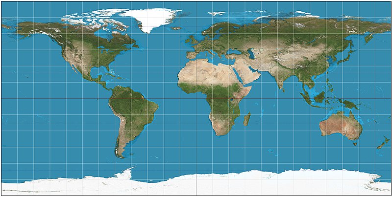
Worldle silhouettes can appear slightly different from what you expect due to map projection effects. Countries near the poles might appear stretched, while equatorial countries maintain more accurate proportions.
The Psychology of Guessing
Your first instinct is often correct, especially for countries with distinctive shapes. Don’t overthink obvious silhouettes, but do take time with more ambiguous ones.
Common Mistakes to Avoid
Random Guessing Early
Don’t waste your first few guesses on random countries. Use them strategically for continental elimination or testing specific hypotheses about the region.
Ignoring Size Context
The silhouette size on your screen correlates roughly with the country’s actual size. Don’t guess massive countries like Russia when looking at a small silhouette.
Overlooking Island Nations
Many players focus on continental countries and forget about island nations. Countries like Madagascar, Sri Lanka, or New Zealand have very distinctive shapes.
Not Using All Available Information
Each guess provides three pieces of information. Many players focus only on distance and ignore direction or proximity percentage. Use all three data points for maximum efficiency.
Building Geographic Knowledge
Regional Focus Sessions
Dedicate practice sessions to specific regions:
Week 1: Focus entirely on European countries Week 2: Master African nations Week 3: Learn Asian countries and territories Week 4: Practice with Americas and Oceania
This systematic approach builds comprehensive knowledge while preventing overwhelm.
Connecting Shapes to Stories
Associate country shapes with memorable stories or facts:
- Finland: Looks like a person pointing east (toward Russia)
- Thailand: Resembles an elephant’s head (fitting for a country where elephants are culturally significant)
- Argentina: The distinctive triangular southern portion (Patagonia region)
These memory associations make shapes stick in your mind.
Using External Resources
Keep these resources handy during practice:
Google Maps: Essential for understanding country positions and sizes Wikipedia: Great for learning about distinctive geographic features Atlas Resources: Physical atlases show topographic features that influence country shapes
Social Learning and Competition
Challenge Friends Strategically
Create friendly competitions that enhance learning:
Speed Challenges: Who can identify a country fastest? Accuracy Contests: Who needs fewer guesses on average? Regional Specialists: Each person becomes expert in different world regions Teaching Exchanges: Share techniques and geographic knowledge
Building a Geography Community
Connect with other Worldle enthusiasts to share strategies, discuss challenging countries, and learn together. Geography knowledge compounds when shared with others.
Advanced Scoring Strategies
Understanding the Scoring System
Worldle scores based on how many guesses you needed and how much you used hints. To maximize scores:
- Identify countries in fewer guesses
- Rely less on hints when possible
- Build speed through pattern recognition
- Focus on accuracy over speed initially
The Perfect Game Approach
Once you’re comfortable with basic gameplay, challenge yourself to achieve perfect games (one-guess identifications) with distinctive countries. This builds confidence and pattern recognition skills.
Measuring Your Progress
Tracking Improvement Metrics
Monitor these key indicators:
Average Guesses per Game: Should decrease over time Regional Accuracy: Track success rates by continent Speed of Recognition: Time from silhouette to correct guess Difficult Country Success: How you handle less common nations
Setting Achievable Goals
Beginner Goals: Correctly identify 70% of countries within six guesses Intermediate Goals: Average 4 guesses per game, 85% success rate Advanced Goals: Average 3 guesses per game, 95% success rate, master all world regions
Turning Worldle into Geographic Education
Learning Beyond the Game
Use Worldle as a gateway to broader geographic education:
Cultural Exploration: Research countries you’ve struggled to identify Physical Geography: Learn about the geographic features that create distinctive country shapes Political Geography: Understand how borders formed and changed over time Economic Geography: Connect country shapes to their natural resources and economic activities
Making Learning Stick
The most successful Worldle players don’t just play - they explore. Each country you identify becomes an opportunity to learn something new about our world.
Your Path to Worldle Mastery
Mastering Worldle Unlimited combines geographic knowledge, strategic thinking, and pattern recognition. Start with the basic strategies outlined here, practice consistently using the unlimited format, and gradually incorporate more advanced techniques.
Remember that every expert was once a beginner who couldn’t tell the difference between Sweden and Finland. With systematic practice and the strategies in this guide, you’ll develop the geographic intuition that makes country identification feel natural and rewarding.
The unlimited format means you can practice as much as you want, turning each session into a geography lesson that’s actually fun. Start with one technique at a time, build your knowledge systematically, and soon you’ll be the person others turn to when they need help identifying that mysterious country silhouette.
Your journey to geographic domination starts with your next Worldle game. Use these strategies, practice consistently, and enjoy discovering just how much of our world you can learn to recognize at a glance.